

Unseen Images From The International Space Centre

1. Stargazing
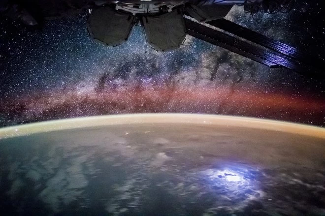 Image source NASAWhat an incredible view from above. NASA said that knowing the exact time and location of the I.S.S. meant that scientists were able to match the star field and describe which stars would be visible at that particular moment. The Milky Way galaxy was identified by the pattern of stars.
2. Colourful Long Exposure
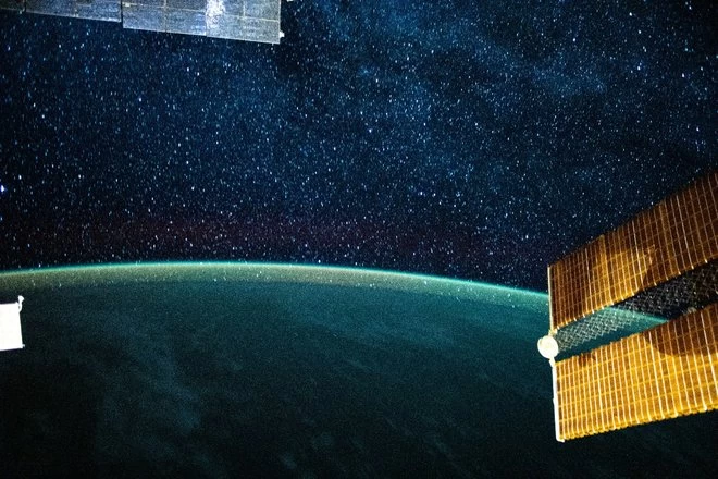
This was taken in July 2020 and the photograph displays a long-exposure image from the International Space station showing a beautiful colourful glow from the Earth's atmosphere. The clarity of the snap is so sharp and far exceeded expectations. It almost looks like a painting!
3. Sierra Nevada De Santa Marta, Northern Colombia
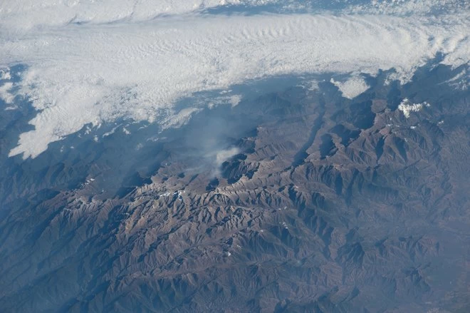
Mountain ranges are regularly captured by those orbiting above and always prove to be popular. These giant masses appear insignificant when seen from this view although they are some of the highest and most impressive sights our Earth has to offer. The photo was taken from a height of 215 miles.
4. I.S.S. Repairs
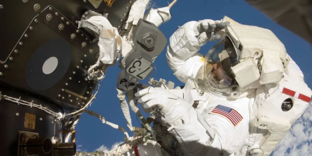 Image source Space Explored
Regular repairs need to be made by the I.S.S. and the crew expect this to be part of their many duties. The astronauts experience the most magnificent views of earth when they are carrying out the necessary work while orbiting the planet. This photo is high above New Zealand.
5. The Nile At Night
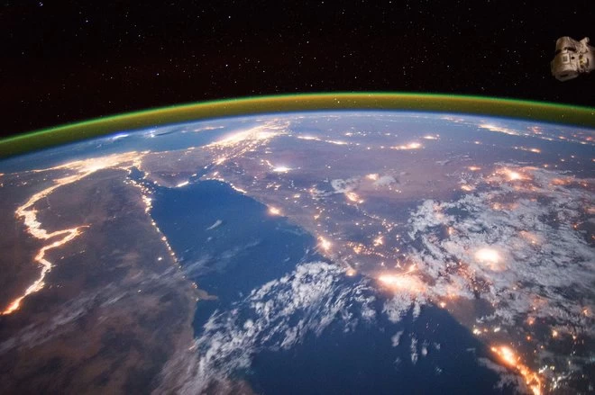
Image source NASA
Another stunning view from the space station was captured by experienced NASA astronaut Scott Kelly. The street lights from the cities and towns below almost look like fires burning on the Earth's surface. Kelly shows the view of the River Nile after dark.
6. Hurricane Gonzalo
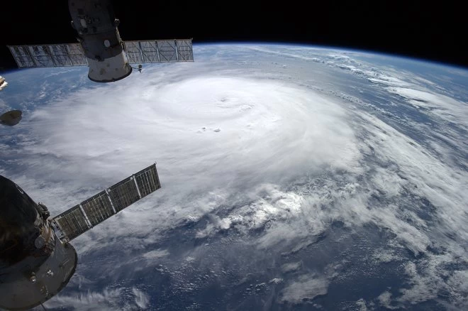 Image source NASA
These very dangerous natural occurrences are made to look like harmless swirls of cloud from above. This image is of Hurricane Gonzalo in 2014 over the Atlantic Ocean and was the second hurricane to strike Bermuda in one week, the first being Hurricane Fay.
7. The Deserts Of Iran
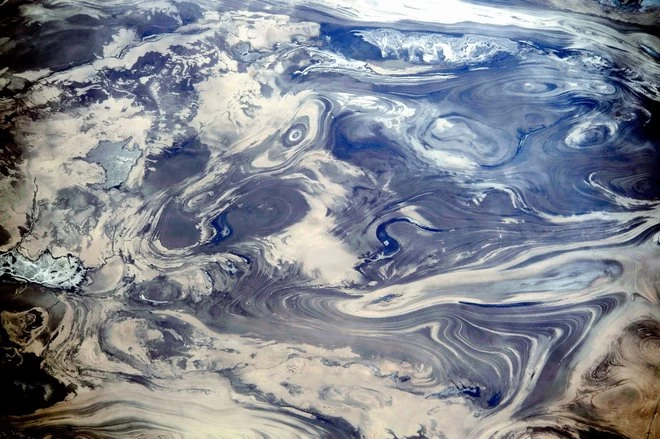 Image source NASA
These views of the deserts of Iran from space show some amazing patterns in the surface below. Looking like swirling fluids these sights are actually rock formations and the results of erosion. A digital camera with a 200mm lens was used to record this image.
8. Snow And Rivers In The Himalayas
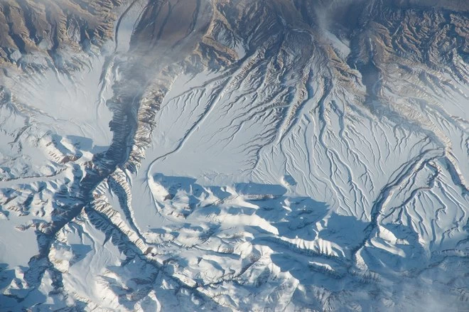 Image source NASA
The Himalayan range of mountains makes for an incredible views if you are ever fortunate enough to see them. The sights look even more intriguing from the International Space Station taken in 2015. The veins on the surface show where waters and rivers have cut through the landscape.
9.The eye of Hurricane Isabel
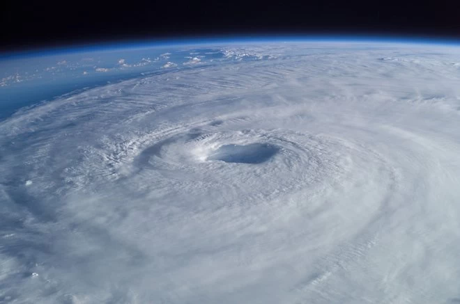 Image source NASA
Snapped in September 2003, this image shows the view over the Atlantic Ocean and the eye of Hurricane Isabel as it passed over that area. The views of the cloud formations and harsh weather conditions look so much less threatening from above. Never thought a storm could look so beautiful.
10. Selfie In The Sun
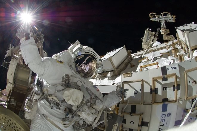 Image source NASA
A spot of sunbathing? Not quite! This closeup of the action shows one of the engineers on the space station carrying out essential repairs during a spacewalk. This image from 2017 shows an excellent view of the sun shining in the distance although it looks like the astronaut is actually touching it!
11. The View From A Visor
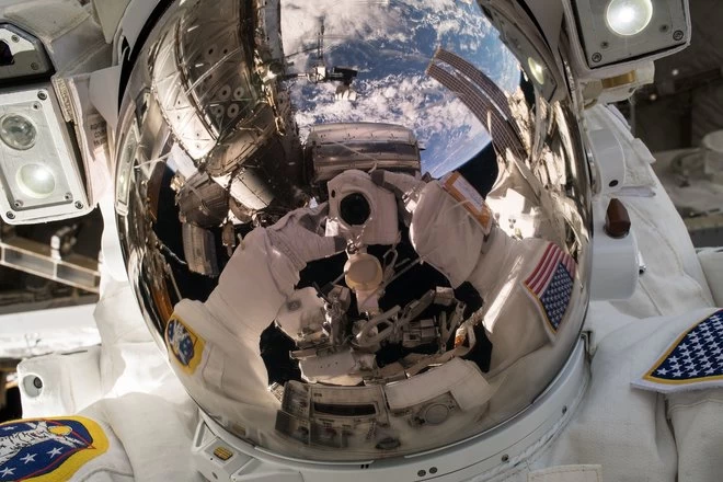 Image source NASA
NASA astronaut Ricky Arnold took a great selfie during the spacewalk in May 2018 where he was performing upgrades on the International Space Station. The image was shared on his Twitter account and, apparently, went absolutely crazy with the amount of views it received within the first 2 hours of release.
12. Momotombo Volcano, Lake Managua
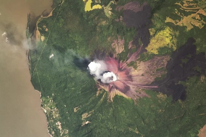 Image source NASA
An astronaut took this photo of Momotombo Volcano in Western Nicaragua whilst aboard the International Space Station in 2018. The area was once referred to as 'the smoking terror' although it looks far from it at this height. From this angle you can view the sulphur-stained peak of the volcano.
13. Mount Cleveland Volcano
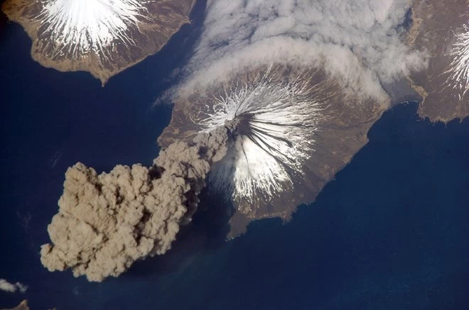 Image source NASA
This amazing image captures an aerial view of Mount Cleveland Volcano in Alaska just as it was erupting. You can see the ash cloud bursting out into the atmosphere! It was photographed by an Expedition 13 crew member on the International Space Station at 3pm (23.00 GMT).
14. Cape Cod, Massachusetts
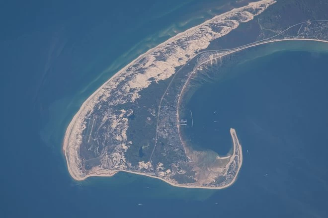 Image source NASA
You're unlikely to ever see a view like this of Cape Cod! The barrier island is thought to be one of the youngest of its kind, probably formed around 20,000 years ago by glaciers. A very long lens shot this detailed image of the northern tip of Cape Cod, showing 8 miles of its 65 mile length.
15. Adele Island, Northwest Australia
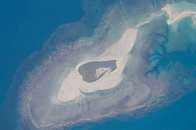 Image source NASAAstronauts above the International Space Station took this detailed image of a tiny island with many zones around the centre. Adele Island is only 2 miles long but the entire tidal zone with all the concentric zones is over 15 miles long, surrounded by extensive sandbanks.
16. Midsummer Sunrise, Gulf Of Saint Lawrence
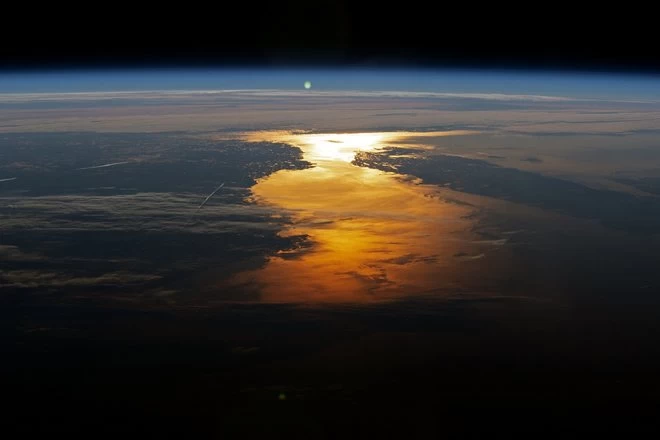 Image source NASA
Another brilliant snap shows the perfect timing to capture the sun-glint. The sun's reflection over the Canadian provinces of Newfoundland were taken at 4 am by an astronaut at the space station which is about an hour and a half earlier than you would see it from the ground.
17. Special Purpose Dextrous Manipulator
Although not the most breath taking of images, this photo is, nonetheless, a very powerful view of the work carried out on the station in May 2019 to repair damaged components. This type of essential work ensures the station can continue to function at full capacity.
18. Laguna Colorada, Bolivia
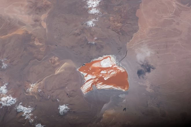 Image source NASA
This incredible image of Laguna Colorada shows a view of the lake below. You can see the changing colours of the water due to the algae that makes up a section of the ecosystem. Astronauts aboard the International Space Station took this photo of the unique part of the Bolivian Andes Mountains.
19. Salt Ponds, Coastal Flats, Western Australia
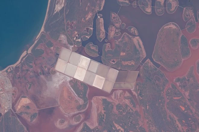 Image source NASA
Images of coastlines are common photos snapped from the International Space Station but this one is exceptionally clear, even by their reckoning. These photos are the best indicators of which part of the world they are looking down at. The familiar lines of the coasts are easy to identify compared with other landmasses.
20. Great Barrier Reef, Near Whitsunday Islands
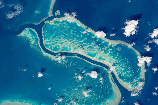
The Great Barrier Reef is impressive from any angle. Almost everyone would see it from tourist photos but astronauts can view the entire reed from 200 miles up. This image shows just 10 miles of the 1,700 mile reef, all the reefs being easily visible from the Station, thanks to the change in colour.
21. Flooding On The Mekong River Floodplain, Thailand And Laos
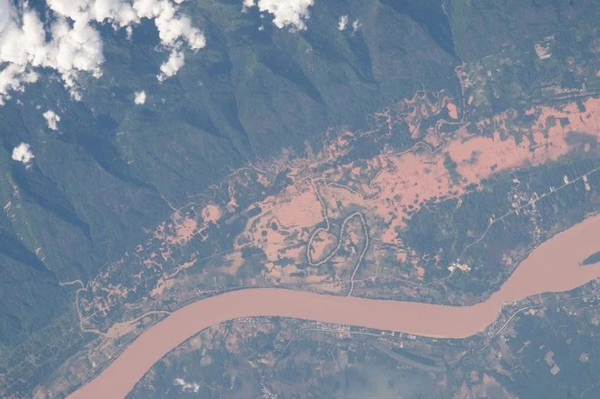 Image source NASA
The Mekong River sits on the border between Thailand and Laos. This photo from the space station was taken in 2015 and shows evidence of flooding in the area. These were caused by heavy monsoon rainfall that fell in July that year and affected everyone in the area. This sort of imagery helps authorities with relief efforts on the ground and saves countless lives.
22. Fish Farms Basins, NE China
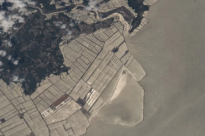 Image source NASA
Astronauts photographed this high-contrast image of the grid patterned fish farms which are on the coast of China. The view includes fish-farm basins that are built out of wood and shallow sea beds, bays and mud flats. Water flows from ships can be seen on the surface below.
23. Sunset over the Med
Everyone loves a sunset but won't have viewed one like this Here is a wonderful view of a sunset over the Mediterranean with the Alps, Adriatic Sea and Italy visible below. The sun is reflected across the surface of the planet and that is a sight of sheer beauty.
24. Night View Of Iberian Peninsula
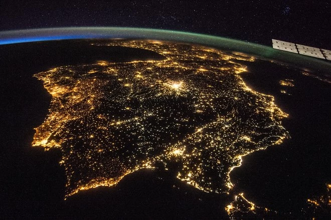
Here is an early evening image of the whole of the Iberian Peninsula, so that would include both Spain and Portugal. The bright glow of the towns and cities below can be easily viewed from 200 miles up. It was taken from the International Space Station in 2014.
25. Flying Through an Aurora
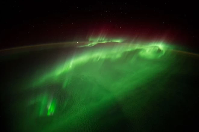
Look at these impressive views caused by small energy particles from the sun when they interact with the magnetic field lines in the Earth's atmosphere. They give off the beautiful red and green light displays in the sky because of the reaction with the oxygen.
26. Russian Resupply In The Night Sky
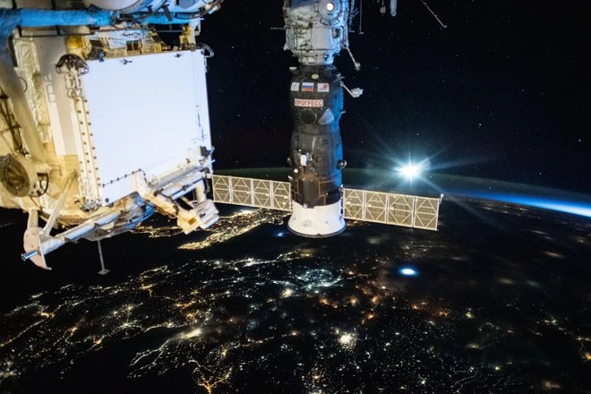 Image source NASA
Here is a great image of a Russian supply ship that can be seen docked with the International Space Station. Below, the lights of Europe can be seen on the surface with millions of people going about their daily lives whilst the Station orbits above them.
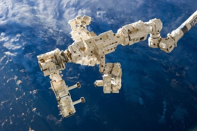
27. Robotic Arm Of The Canadarm2
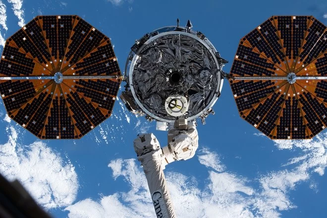 Image source NASA
A pretty magnificent view of the tech used aboard the International Space Station. The Cygnus space freighter, with its prominent cymbal-shaped ultra flex solar arrays, is pictured just after after its release from the Canadarm2 robotic arm which ended its 83 day stay at the I.S.S.
28. San Francisco Bay
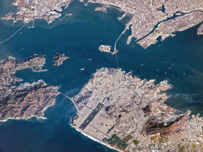
Here is an interesting view of San Francisco from high above which shows the striking size of the bridges that connect it to Oakland and the Golden Gate Bridge. An impressive sight is the large patch of greenery that forms Golden Gate Park from this height.
29. Mount Everest
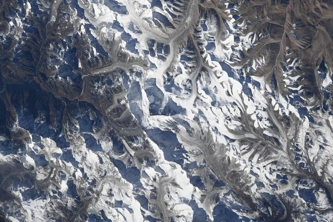 Image source Mark T Vande/NASA
NASA Astronaut and Flight Engineer for the International Space Station was Mark T Vande who took this impressive image from the top down of Mount Everest from onboard the Space Station. He set a challenge to Twitter viewers to see if they could spot the mountain in the range spanning the ground below!
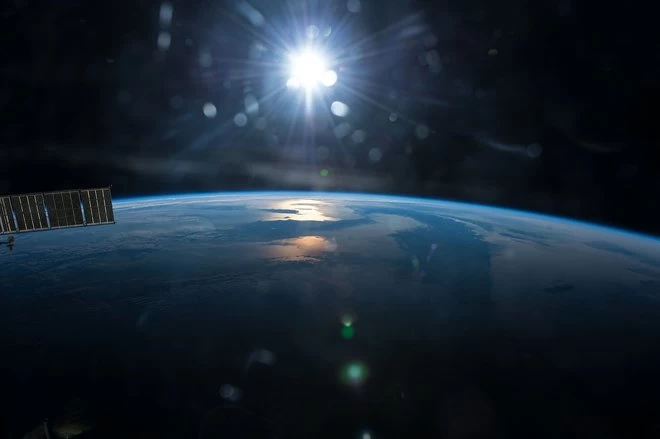
30. The Earth Is Round!
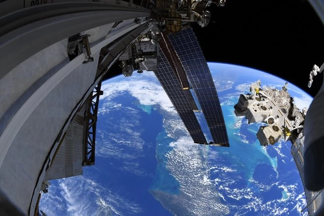 Image source NASA
This view says it all! The photo was taken during a space walk and shows not only the fantastic curve of our home planet but also the stunning blue hue of the Caribbean Sea below. Many enthusiastic photographers love to capture a great panoramic view on their cameras but, snapping from space, takes the whole experience to another level.