Tropical Storm Melissa on Track to Become a Life-Threatening Hurricane in the Atlantic – Here’s What We Know So Far

This latest tropical storm is reportedly gaining strength, and here's what to know about its path, risks, and why it may still become a late-season hurricane.
A growing threat is building over the Caribbean as Tropical Storm Melissa gathers strength, with state weather forecasters now warning it could reach hurricane status within days.
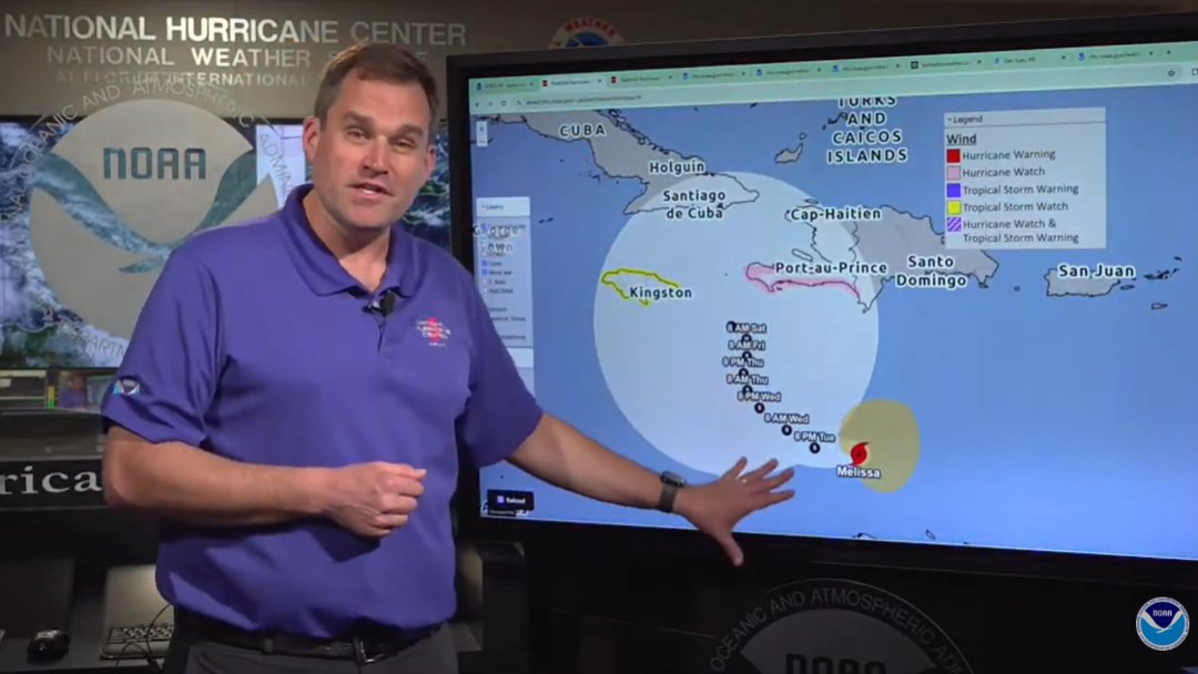
National Hurricane Center Director Dr. Michael Brennan gives an update on Tropical Storm Melissa, posted on October 21, 2025 | Source: YouTube/nwsnhc
As watches are issued and communities prepare, concerns are mounting over dangerous winds, heavy rain, and flooding, especially in the vulnerable northern Caribbean. Officials are advising residents to monitor updates and prepare accordingly.
According to the update from the National Hurricane Center (NHC) at 2 a.m. EDT, the center of Tropical Storm Melissa was located near latitude 14.2° North and longitude 74.0° West, approximately 325 miles south-southwest of Port-au-Prince, Haiti.
The storm was moving west at 12 mph, with maximum sustained winds of 50 mph and a central pressure of 1003 millibars.
Melissa is expected to slow its forward speed before turning northwest, then north, later in the week. On this track, the storm could approach Jamaica and southwestern Haiti by Thursday or Friday. Strengthening is expected, with Melissa potentially becoming a hurricane within 48 hours.
The storm could bring 5 to 10 inches of rain to southern Haiti and the southern Dominican Republic, with isolated higher amounts in some areas. Eastern Jamaica may see 4 to 8 inches, while northern Haiti and the northern Dominican Republic are forecast to receive 2 to 4 inches.
Western Jamaica, Puerto Rico, and Aruba could see 1 to 3 inches, with the risk of life-threatening flash floods, urban flooding, and landslides, especially in mountainous areas.
https://www.instagram.com/reel/DQFfFswjhzb/?mWidth=350&mHeight=659&dWidth=600&dHeight=970Tropical-storm-force winds are already stretching up to 140 miles from the center, and rough seas and hazardous marine conditions are expected across much of the northern Caribbean.
https://www.instagram.com/reel/DQFTMlZCtY9/?mWidth=350&mHeight=418&dWidth=600&dHeight=558A Hurricane Watch has been issued for the southwestern peninsula of Haiti, from the Dominican Republic border to Port-au-Prince. A Tropical Storm Watch is also in effect for Jamaica, indicating possible storm conditions within 48 hours.
While Cuba and the Dominican Republic are not currently under official warnings, both countries lie within the forecast cone. Residents are advised to monitor updates closely and be ready in case conditions worsen.
According to CNN, while a direct hit on the U.S. mainland is unlikely, the storm could still bring rough surf and rip currents along the East Coast next week. If Melissa stays weaker longer and delays its northward turn, there is a chance for more significant wind and rain across Florida, Cuba, and the Bahamas.
Although late-season hurricanes are less common, storms like Hurricane Nicole in November 2022 and Hurricane Zeta in October 2020 prove that the threat can linger well into the fall. The Atlantic hurricane season reportedly ends on November 30.
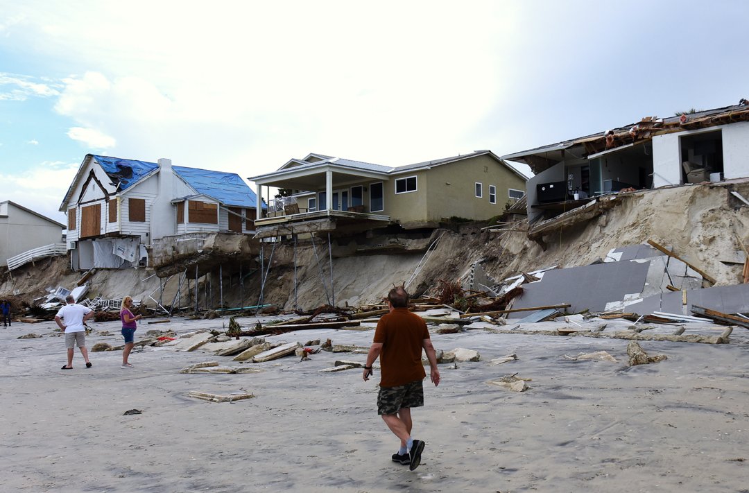
Homes damaged by coastal erosion after Hurricane Nicole's landfall in Florida, November 11, 2022 | Source: Getty Images
Hurricane Erin, which formed in August 2025, never made landfall — but still became a major coastal threat. The storm remained well offshore from Florida to Virginia and North Carolina, yet it generated tropical-storm-force winds over 500 miles from its center.
A strong high-pressure system to the north created a sharp pressure gradient, producing sustained winds of 25 to 30 knots (29–35 mph), with gusts up to 40 knots (46 mph) over the water and near the coast.
Winds shifted from the northeast to due north between August 20 and 21, helping to drive 12- to 18-foot waves toward the shores of Virginia, North Carolina, and Maryland, triggering widespread beach and dune erosion.
Erin also caused tidal anomalies of 2.5 feet above normal across the lower Chesapeake Bay and Atlantic coastlines. The highest water levels occurred during overnight high tides, with tide gauges surpassing major flood stage in Lynnhaven, Kiptopeke, and Duck, North Carolina.

"No swimming" warning flag flies at Rockaway Beach, New York, on August 21, 2025, as Hurricane Erin causes rough surf and rip currents | Source: Getty Images
While upper Chesapeake Bay areas were spared initially, tidal flooding rose to moderate levels by August 23, as calmer winds trapped water inland, a common but often overlooked flooding pattern in the region.
Though Erin brought no direct rainfall or tornadoes, the storm's wide wind field and tidal surge caused serious impacts.

Passengers leave the last ferry in Oak Bluffs, Massachusetts, on August 20, 2025, ahead of Hurricane Erin's expected impacts along the New England coast | Source: Getty Images
Authorities responded swiftly. The National Weather Service (NWS) and NOAA delivered livestreamed briefings and coordination messages to emergency managers and the U.S. Coast Guard.
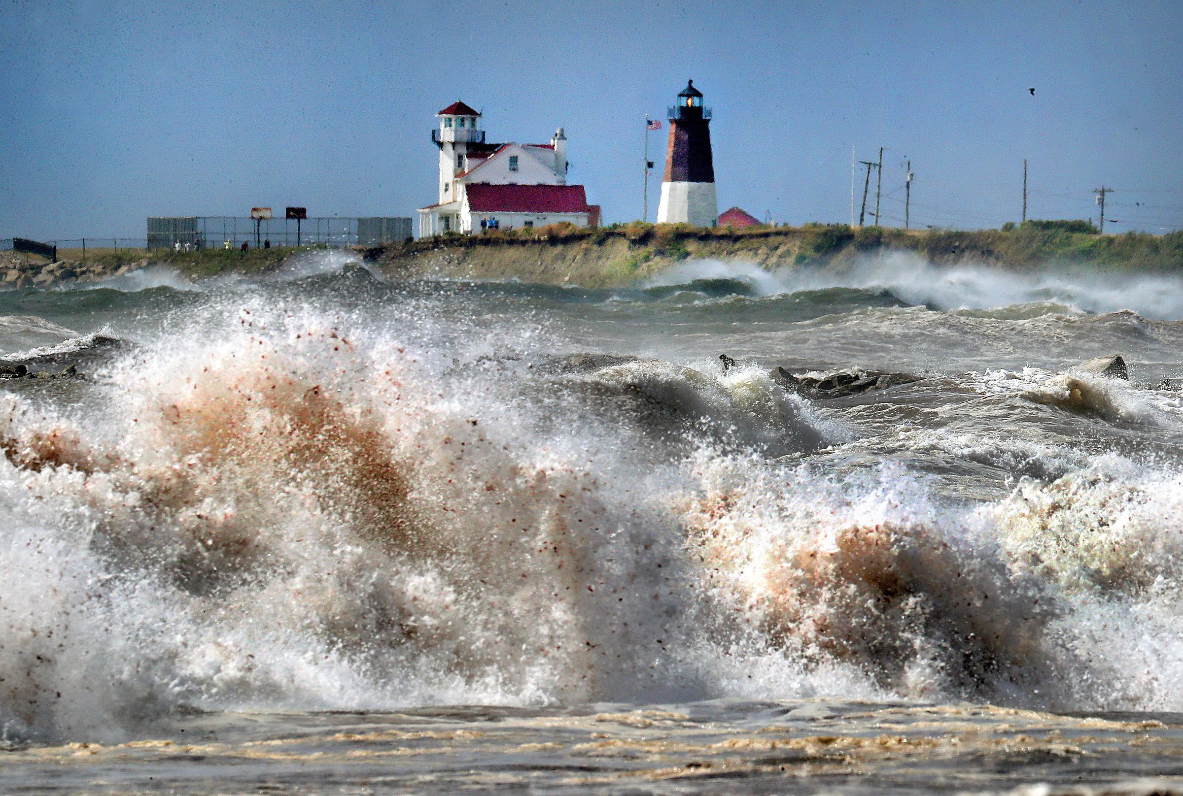
Large waves crash along Scarborough State Beach in Rhode Island as Hurricane Erin churns offshore on August 20, 2025 | Source: Getty Images
New rip current risk graphics were introduced to better inform the public, while shipping operations were modified and port access restricted in areas including Puerto Rico and the U.S. Virgin Islands. These early actions helped minimize damage.