
What International Borders Look Like Around The World

Baarle-Hertog/Baarle-Nassau, Netherlands and Belgium
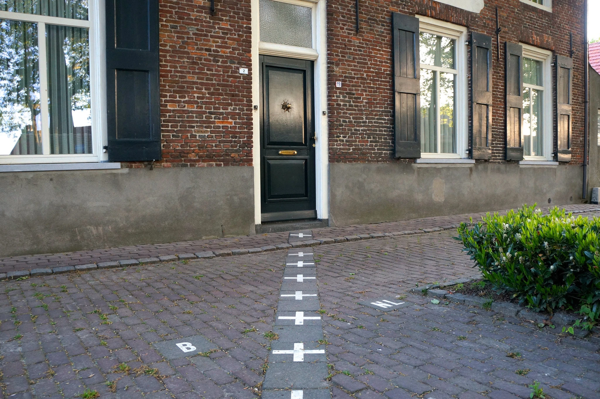 Image Source/ Culture TripThis has to be my favourite on this list. The grey lined bricks on the pavement stipulate the border between Netherlands and Belgium, and there are a number of these Belgium exclaves dotted around the Dutch city of Baarle-Nassau. They are rich with history, being places where trades used to happen.
Advertisement
Cooch-Behar District, India and Bangladesh
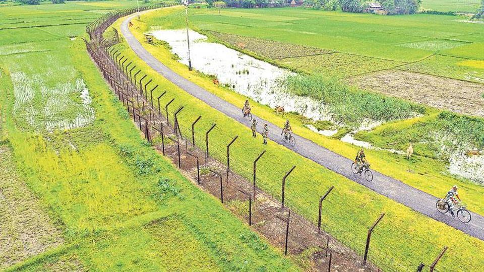 Image Source/ Hindustan TimesSo here is where it gets complicated... the Cooch-Behar District is very similar to that of the border between Belgium and Netherlands. However, there are multiple exclaves belonging to both India and Bangladesh that weave between each other, meaning there are territories surrounded by both countries.
Advertisement
Ceuta and Melilla, Morocco and Spain
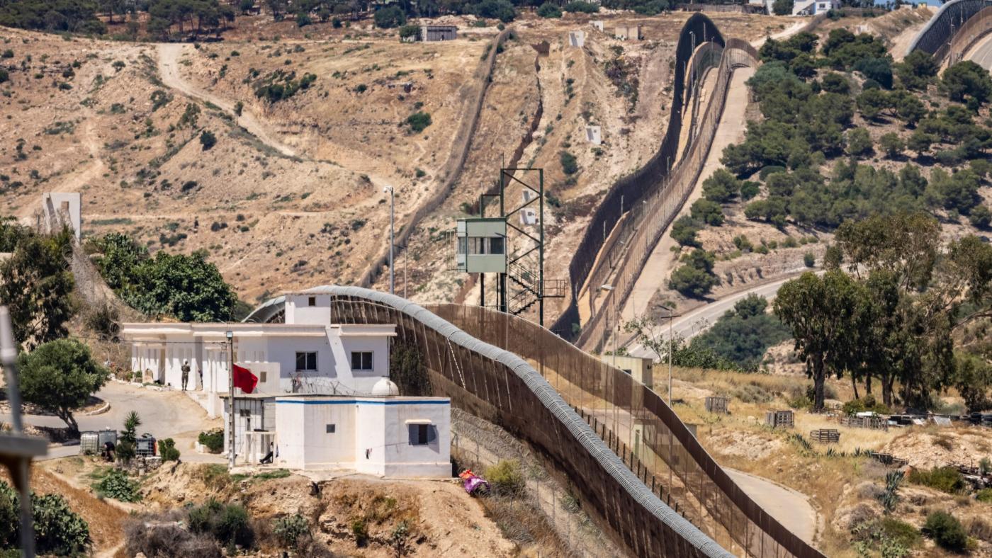 Image Source/ Middle East EyeWhile the borders between themselves might not be so unique, the placement of these two cities is what makes them so fascinating. Being Spanish territories in Morocco, many people seek EU citizenship their by crossing the borders and entering the cities.
Advertisement
Denmark and Sweden
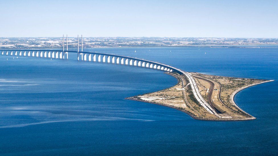 Image Source/ BBCWhat a great way to connect two neighbouring countries! Denmark and Sweden agreed a bridge that actually goes underwater (so kind of not a tunnel too) that connects regions from both countries. It's seems like an efficient way to work (and to commute too!).
Advertisement
Diomede Islands, Russia and U.S.A
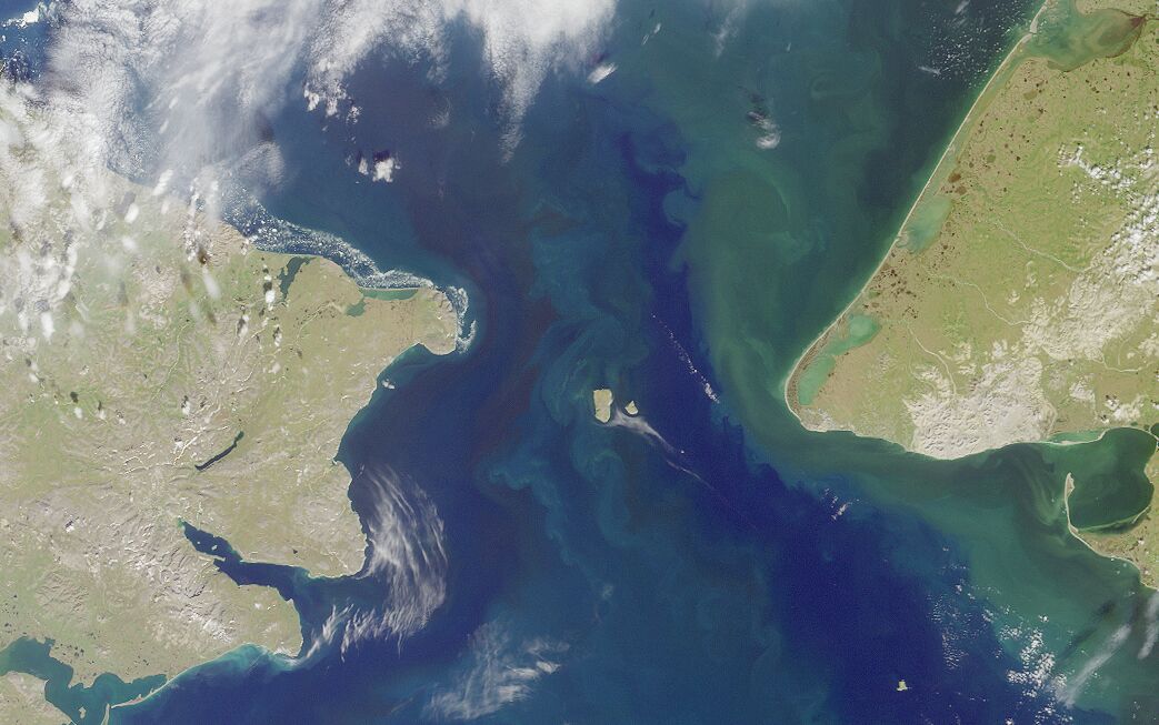 Image Source/ WikipediaYou'd think that the countries of Russia and U.S.A would be quite far away from each other, but you'd actually be wrong. The countries meet in the Diomede Islands, Big Diomede and Small Diomede. The countries actually connect through Alaska's and Okrug's borders.
Advertisement
Finland, Sweden, and Norway
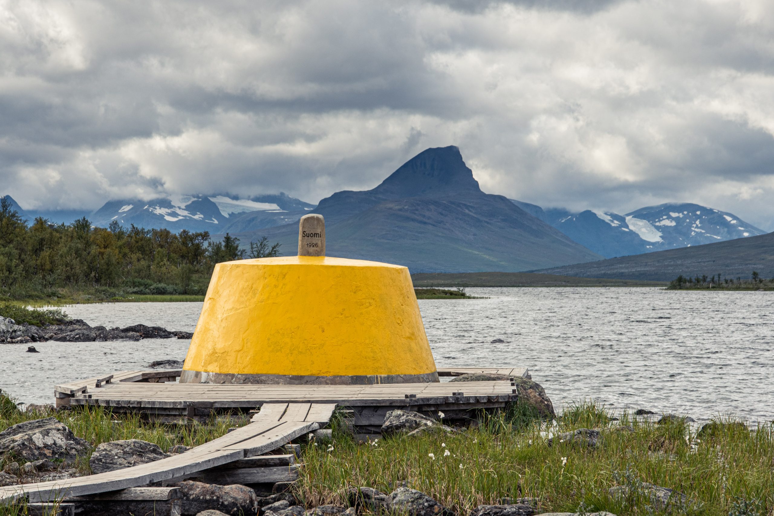 Image Source/ Visit LyngenfjordIt seems like the Nordic countries know how to pinpoint their borders meeting the best. I mean, just take a look at this. This structure built outwards into this lake commemorates the space where Finland, Sweden and Norway meet, unifying the three countries in a way.
Advertisement
The DMZ, North Korea and South Korea
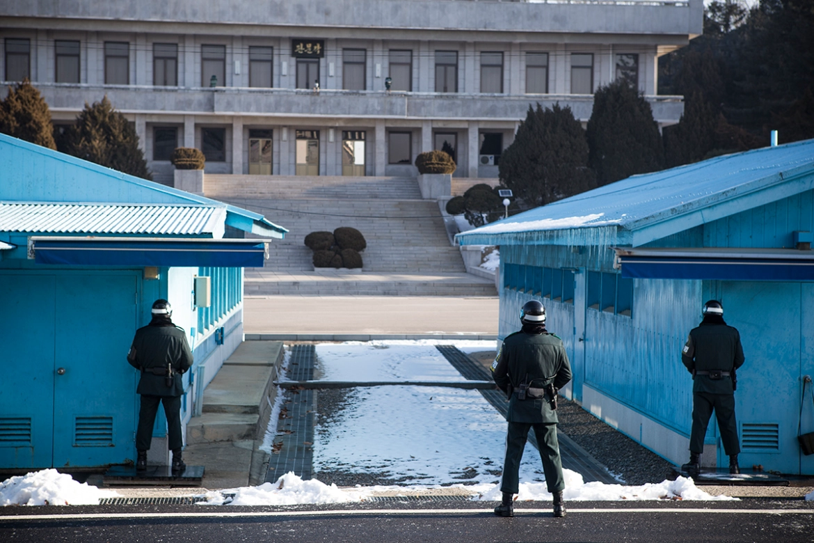 Image Source/ Al JazeeraNow this looks like a scary border, and no surprise comes within North Korean territory. DMZ stands for demilitarised zone and stipulates the border between South Korea and North Korea. It's considered to be one of the most dangerous in the world, as both countries are always on high alert.
Advertisement
Germany, Netherlands, and Belgium
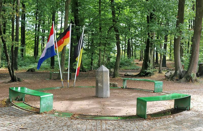 Image Source/ The GateAnother triple whammy in this one, all three countries came together to plant their flags at the points where all of the countries meet. Germany, Netherlands, and Belgium planted benches around a concrete point stipulating the union point of all three countries.
Advertisement
Hadrian's Wall, Scotland and England
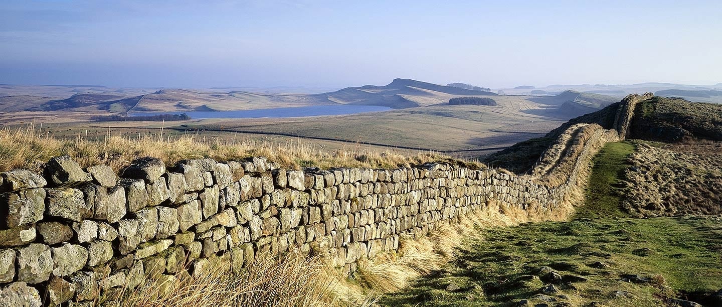 Image Source/ English HeritageWhile it's no longer fully built and much of it has been knocked down, Hadrian's Wall is a stone wall built to separate the borders between England and Scotland during the Roman reign of England. The Romans were apparently afraid of the Scots and built this structure to keep them out.
Advertisement
Haskell Free Library and Opera House, U.S.A and Canada
 Image Source/ Borderline PlayersThis might just be the most interesting border on this list. Haskell Free Library and Opera House is built on the border between Vermont and Quebec. While both countries allow you entry, if you leave using the wrong exit you will be fined and possibly even arrested.
Advertisement
Haiti and the Dominican Republic
 Image Source/ UN Environmental ProgrammeI think this goes to show the difference in values between each of the neighbouring countries. This photo shows the border between Haiti and the Dominican Republic. Both countries have a massive difference in their environmental protection laws, which really shows.
Advertisement
Iguazu Falls, Argentina and Brazil
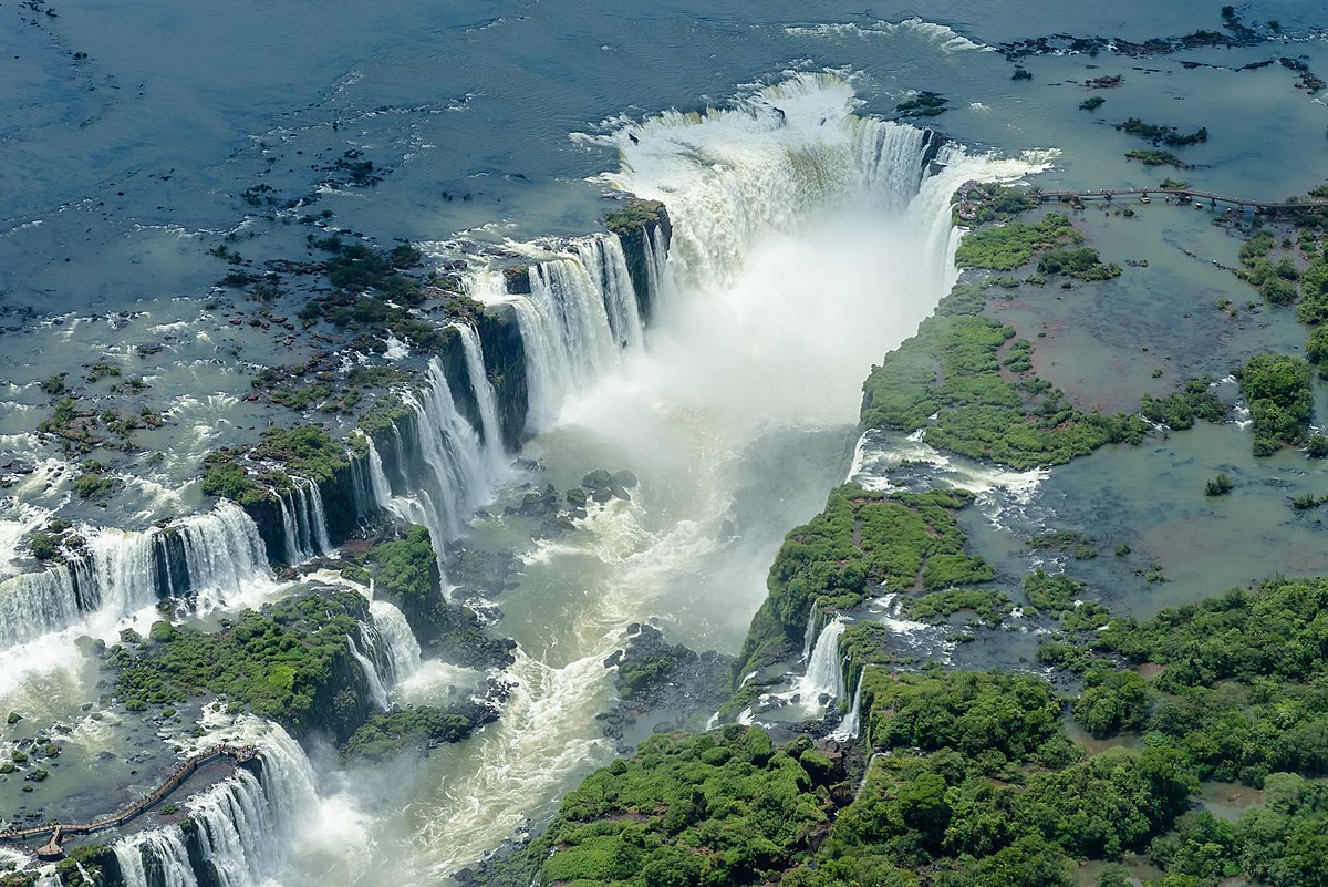 Image Source/ WikipediaRight, so we all have to admit that this is the most beautiful border between two countries in the world, right? Iguazu Falls lies at the bordering space between the countries Argentina and Brazil. It must be pretty amazing to live there and be spoiled with these sights.
Advertisement
Kaliningrad, Poland and Russia
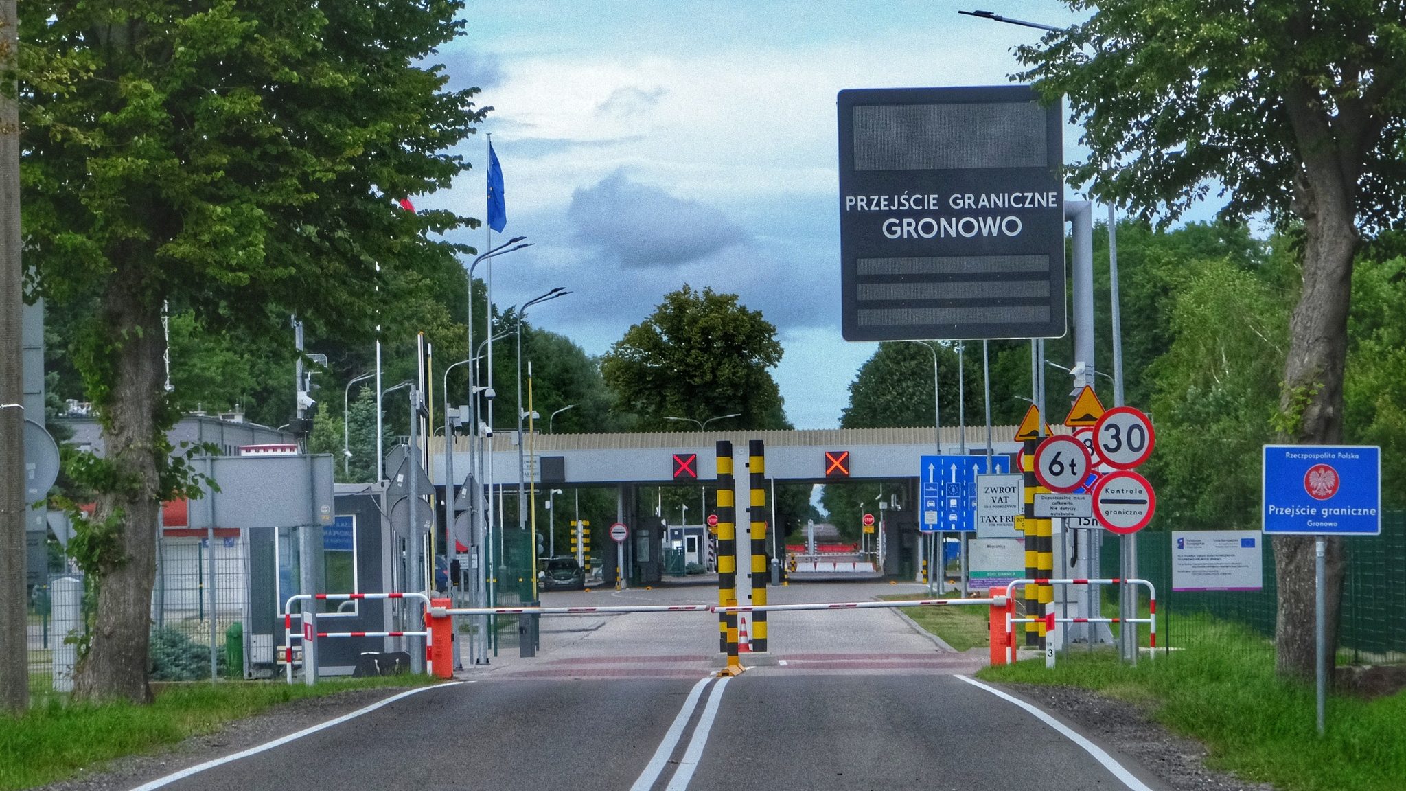 Image Source/ Balkan InsightFollowing the downfall of the infamous Soviet Union, the countries of Europe started reclaiming their territories back, but Kaliningrad was not one of them. The Soviet Union took it over from Poland, and Poland nor Lithuania dared take the place back, so now Russia own it.
Advertisement
Lake Constance, Austria, Switzerland, and Germany
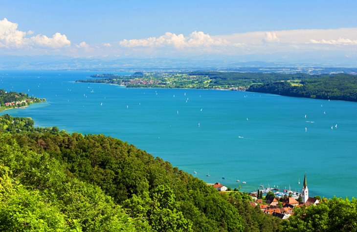 Image Source/ PlanetWareHave you ever seen the border of three countries residing in one lake? Well, now you have. Lake Constance lies directly at the meeting points of Austria, Switzerland and Germany. It joins together the Austrian state off Vorarlberg, the Swiss canton of St. Gallen and German states of Bavaria and Baden-Württemberg.
Advertisement
Llivia, Spain and France
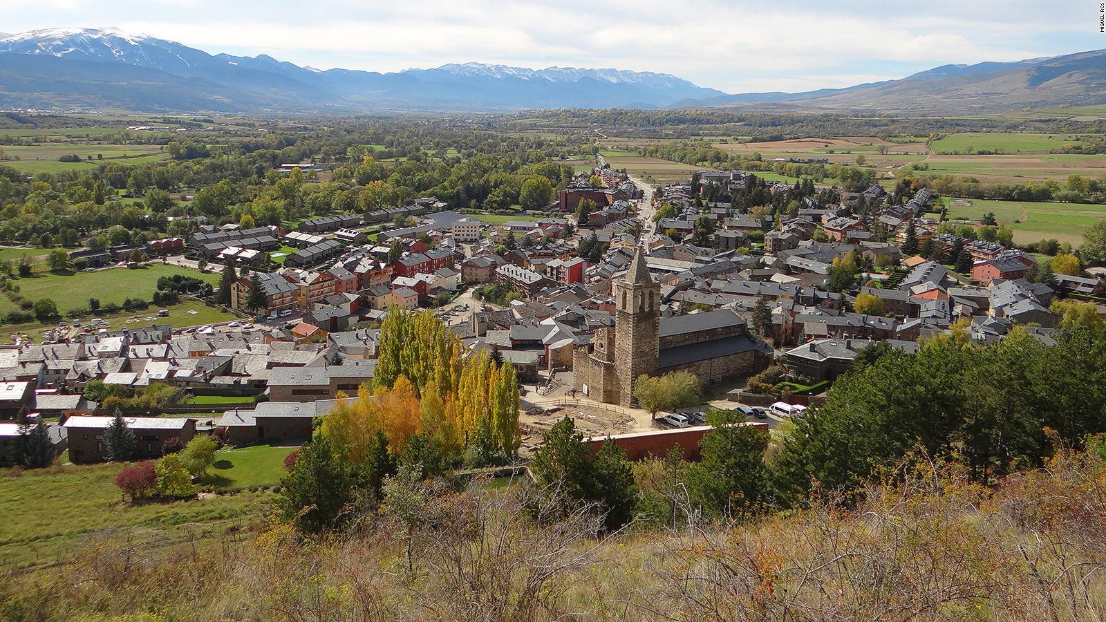 Image Source/ CNNBack when France was colonising parts of Spain, the residents of Llivia revolted. They didn't want to become a French territory so managed to resist and remain a part of Spain, even though the town is actually just over 1km away from mainland Spain itself.
Advertisement
Jungholz, Austria and Germany
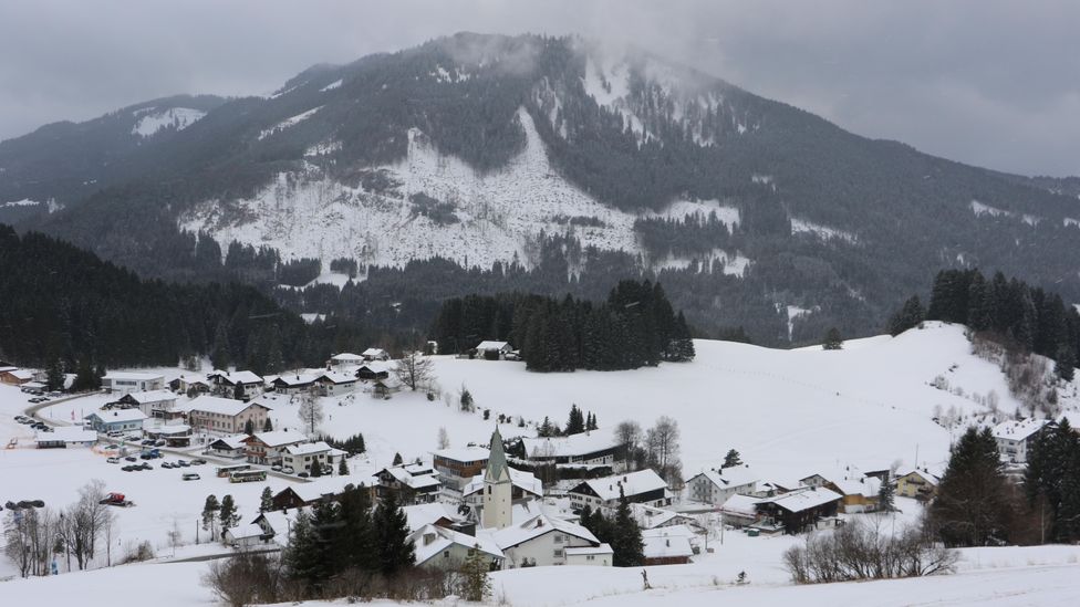 Image Source/ BBCNow, this might not look as though the border is strange, but to reach Jungholz in Austria you actually have to leave the country. Or, you could just climb the mountain but that will take much more effort, and you could always just use the road that takes you into Germany so you can reach your destination in Austria!
Advertisement
Musandam Governorate, Oman and U.A.E
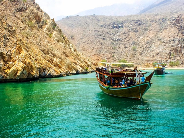 Image Source/ RedditWhile the borders between Oman and U.A.E aren't too dissimilar to those of the countries around it, the citizenship of its Musandam Governorate residents is what makes it so peculiar. When U.A.E was establishing itself, it offered the residents Omani or Emirati citizenship, with most opting for Omani.
Advertisement
Naco, U.S.A and Mexico
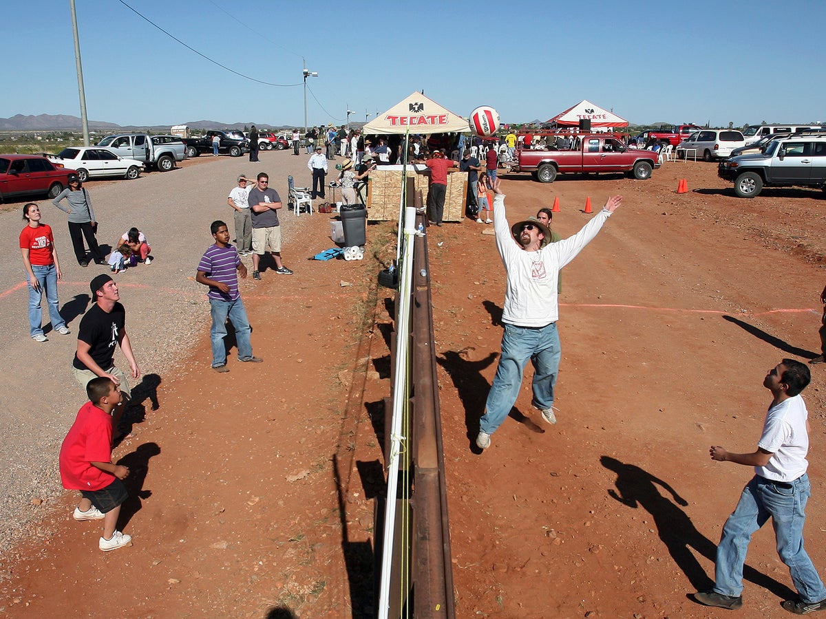 Image Source/ The IndependentThis is probably one of the most endearing borders in the world, and this photo evidences why. This is the border between Naco, Arizona and Naco, Mexico and as you can see is a popular spot for the residents to get together and have a light-hearted game of volleyball.
Advertisement
Nagorno-Karabakh, Armenia and Azerbaijan
 Image Source/ Egypt IndependentBetween the borders of Armenia and Azerbaijan lies Nagorno-Karabakh. While it is officially an Armenian exclave situated in Azerbaijan, people have tried to claim it as it's own Republic of Artsakh. However, it hasn't officially been recognised as this yet and so remains unrecognised.
Advertisement
Norway and Sweden
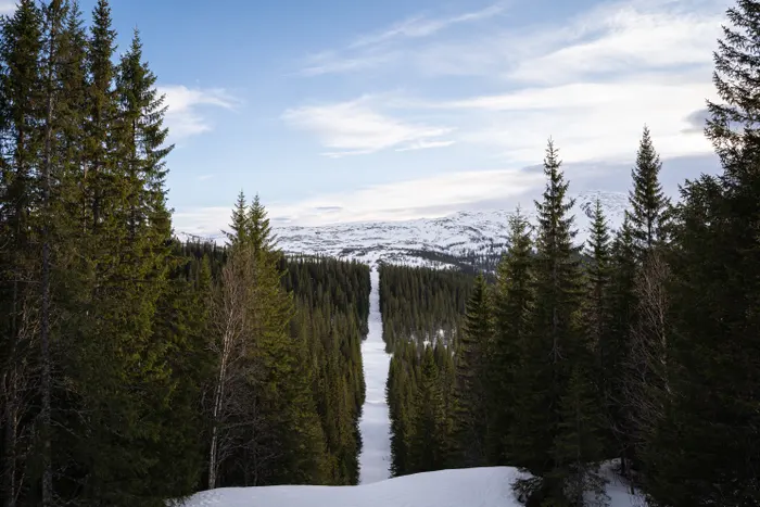 Image Source/ The GuardianThis is a great border for a picture opportunity and there's loads out there if you want to see. The border between Norway and Sweden is made prominent by this long stretch of road the reaches into the distance with tall trees towering over the road from each side.
Advertisement
Penon de Velez de la Gomera, Morocco and Spain
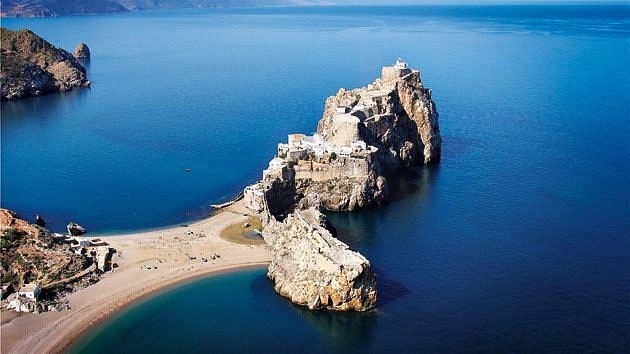 Image Source/ TripAdvisorPenon de Velez de la Gomera is the border that separates the countries of Morocco and Spain. Being only 85 metres long, it's officially declared the shortest border between any two countries in the world, and Spain put on an army presence as to deter Morocco away from claiming the territory.
Advertisement
Point Roberts, U.S.A. and Canada
 Image Source/ Los Angeles TimesPoint Roberts is U.S. territory, yet not one bit of it actually touches the States itself. It lies south of the 49th parallel and actually resides in the country of Canada, despite being an American exclave. There's territories like this around the world that aren't connected to their home countries.
Advertisement
Poland and Ukraine
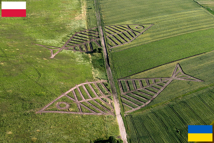 Image Source/ Bored PandaOne of the pretties borders between two countries has to be this one where the countries of Poland and Ukraine meet. It's nice to see countries come together and agree a great way to commemorate the aligning of two different countries while celebrating their union.
Advertisement
San Marino and Italy
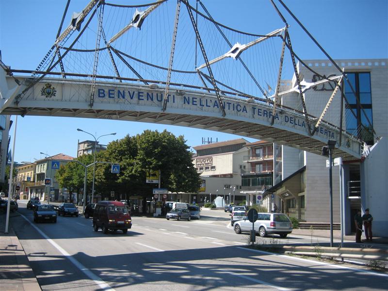 Image Source/ public.asu.eduSan Marino is entirely surrounded by neighbouring country Italy. It's a completely independent country though and claims to be the oldest constitutional republic in the world. It's history dates back to 301 AD when Marinus of Rab fled Roman Emperor Diocletian and founded the country.
Advertisement
Slovakia, Austria, and Hungary
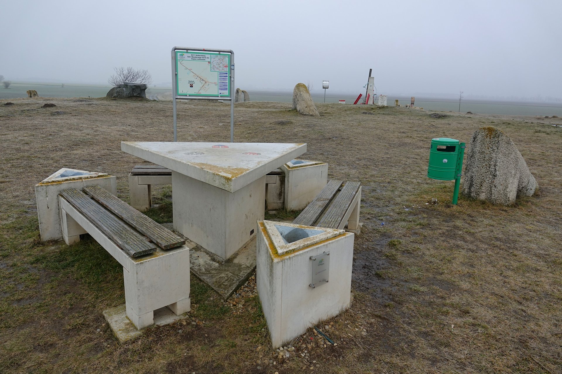 Image Source/ Bjorn FreeI think this has to be one of the most unique borders on this list. The table (and benches) symbolise the exact meeting point between three different countries; Slovakia, Austria, and Hungary. Each countries' bench is outlined by the symbols on the triangle table.
Advertisement
Spain and Portugal
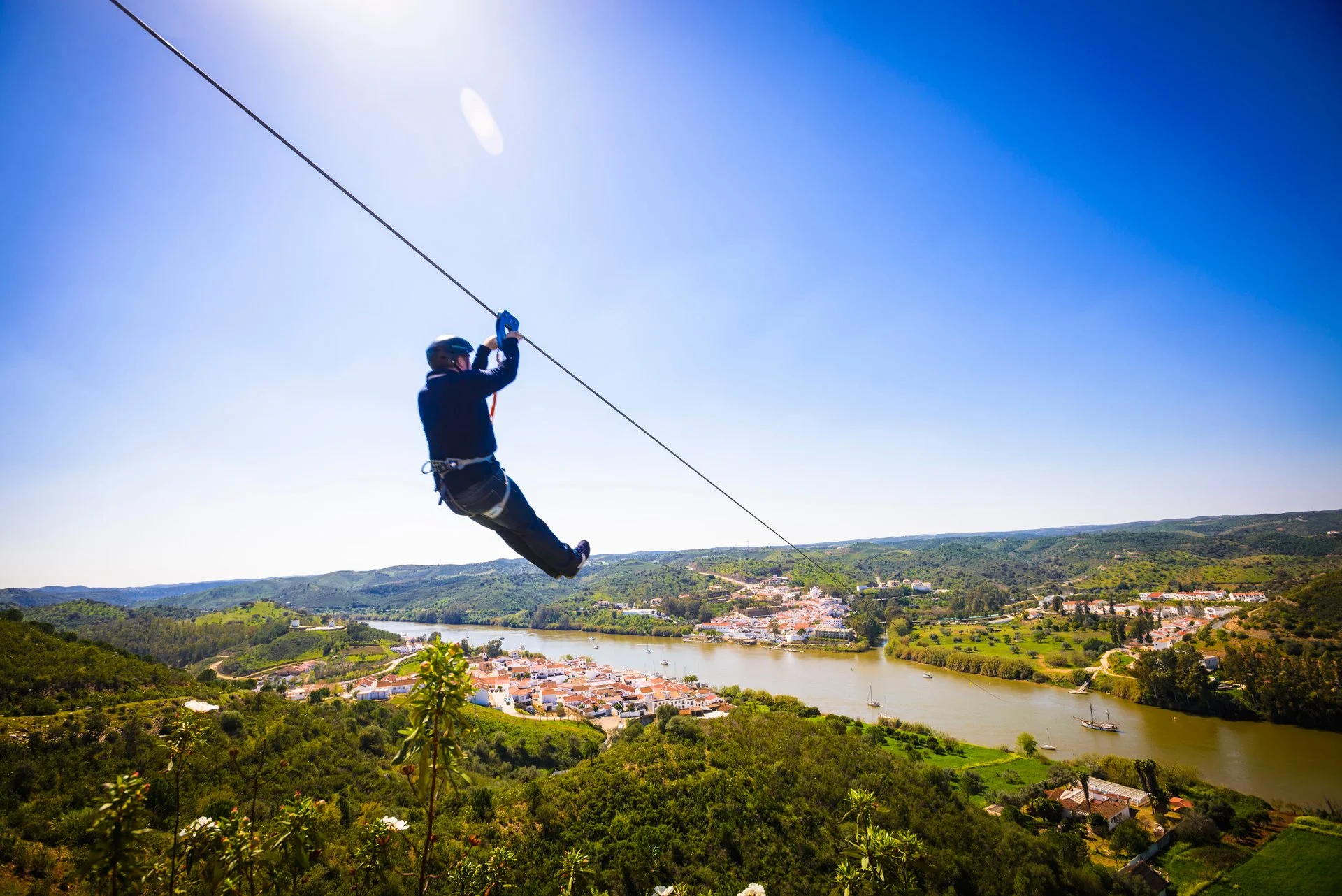 Image Source/ Rove.meNeed a quick way to get from Spain to Portugal? Look no further. This has to be one of the only ziplines in the world that connected two countries together and remains to be a massively popular tourist hotspot location in Spain. I bet that's the quickest border crossing anybody has ever done!
Advertisement
Thailand, Myanmar, and Laos
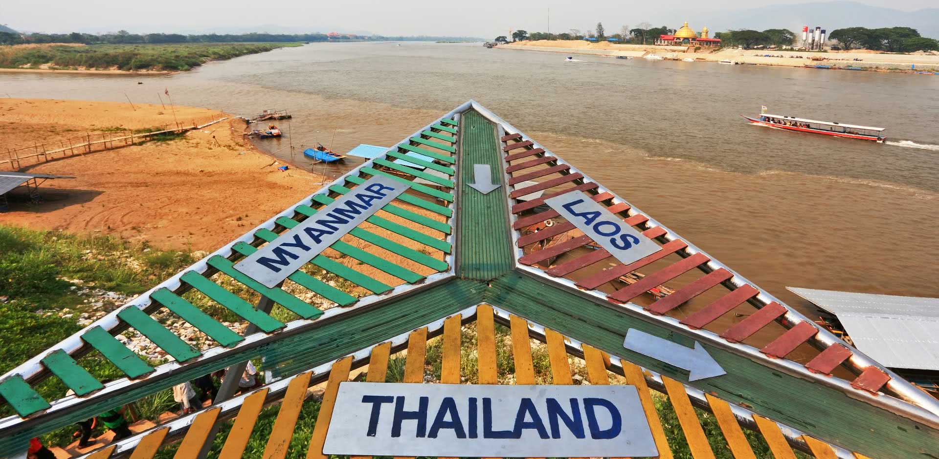 Image Source/ Remote LandsThese three countries decided to commemorate the joining of their borders in a peculiar and unique way. It probably attracts many tourists, how many people can say they visited the point between three different countries? This triangle evidences the Myanmar, Thailand, and Laos territories.
Advertisement
Usedom, Germany and Poland
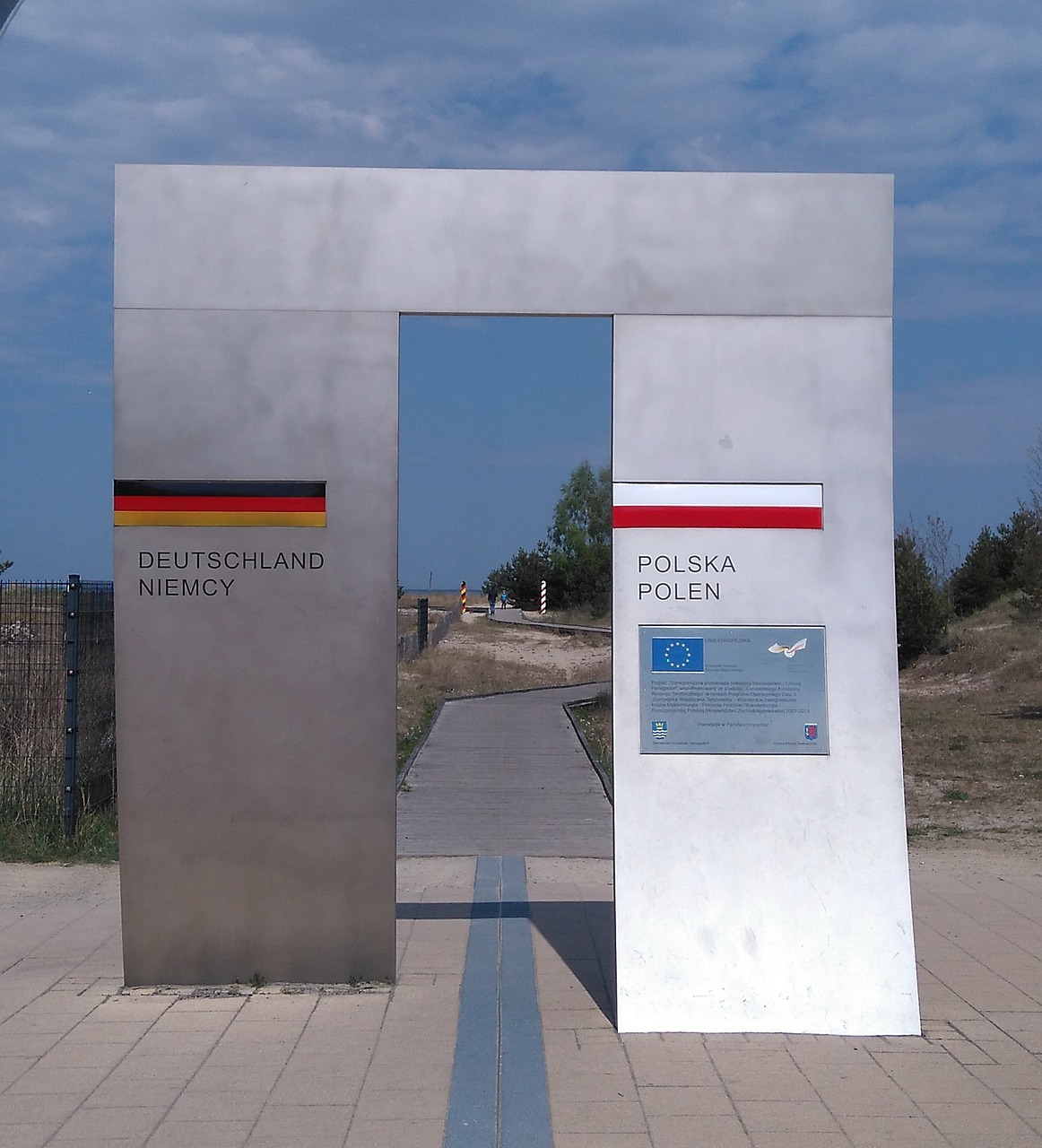 Image Source/ PixabayFancying a holiday but can't decide between two destinations? Choose both! Well, as long as the destinations are Germany and Poland, and the kind of holiday you are looking for is at the beach of Usedom. This metal structures lies right by the beach and lets tourists know which country they're currently a part of.
Advertisement
Vatican City, Vatican and Italy
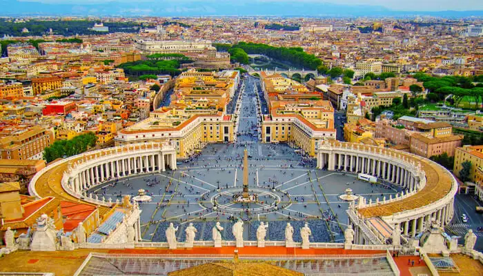 Image Source/ Travel TriangleMany know the Vatican for being the smallest country in the entire world, and also home to the Pope. Well, the borders of the independent country is surrounded by the city of Rome, and the country brings a lot of attention and tourism to Rome itself.
Advertisement
Vorukh, Tajikistan and Kyrgyzstan
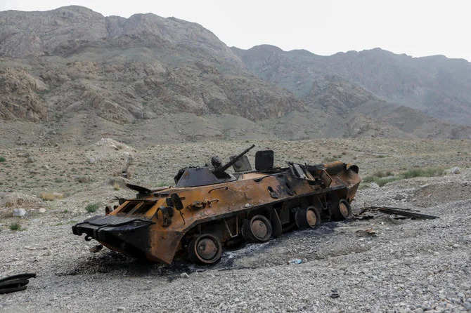 Image Source/ The Economic TimesThe USSR (Union of Soviet Socialist Republics) fell in the 1990s and left many complications with borders and territories, like Vorukh. The exclave is based in Kyrgyzstan is supposedly a Tajik territory, and the residents there won't leave in fear of their lives.
Advertisement
'The Border of Peace' Brazil and Uruguay
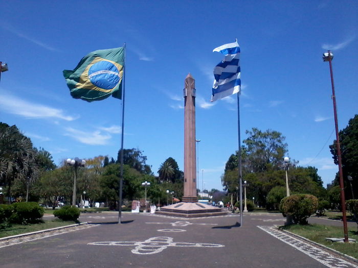
Image source/reddit
The peace border is the border that runs between Brazil and Uruguay. It runs through the division between River city of Uruguay and the city Santana do Livramento of Brazil. The name and the border signifies a close union between the two of the countries.Advertisement
The Friendship Bridge, Vietnam and China
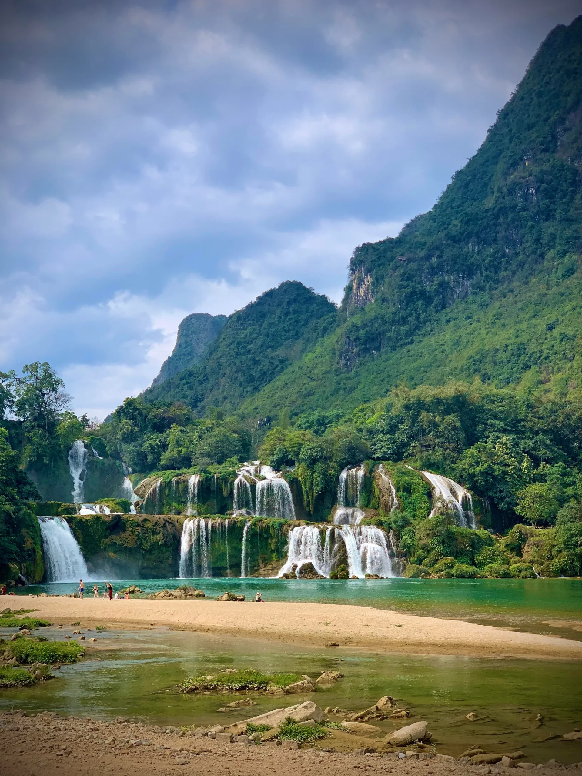
Image source/reddit
The Friendship Bridge between Vietnam and China is around 100 metres long. It is symbolic of the development of the Sino and Vietnamese relationship that has been built on over the years. In the middle of the bridge there is a zebra crossing. The bridge is used for a lot of different trades.Advertisement
Ukraine and Slovakia
Image source/bored panda
Ukraine and Slovakia formed a diplomatic relationship in 1993. The two countries are allies and the border can be seen by this long strip of land which symbolises the end or beginning or the different territories. As we can see, the border symbolises the friendship between the two countries.Advertisement
Russia and Estonia
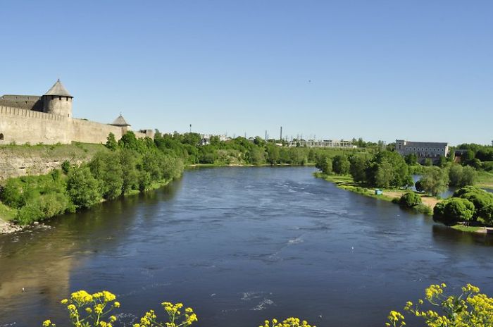
Image source/reddit
The river Narva we can see here acts a a border between Russia and Estonia. Russia is on the left of the river, separated from Estonia on the right. There is 'The Narva Friendship Bridge' which crosses the river which intended to symbolise a good relationship between the countries.Advertisement
Switzerland and Liechtenstein
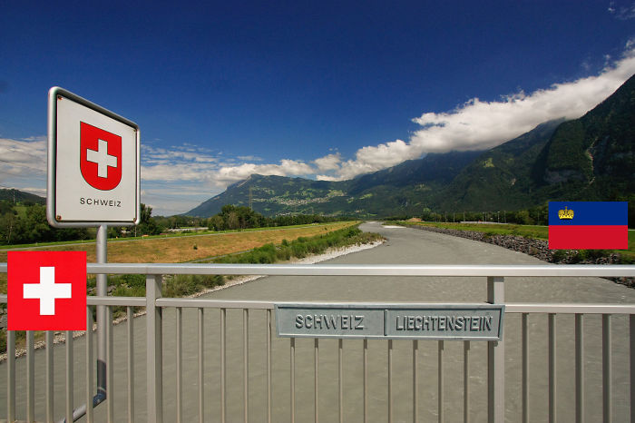
Image source/bored panda
The Switzerland and Liechtenstein border is shown here with the creation of a gate with both countries' names written side by side. Despite the physical border here, the majority of the border between the two countries is open, many of it runs along the Alps.Advertisement
France and Italy
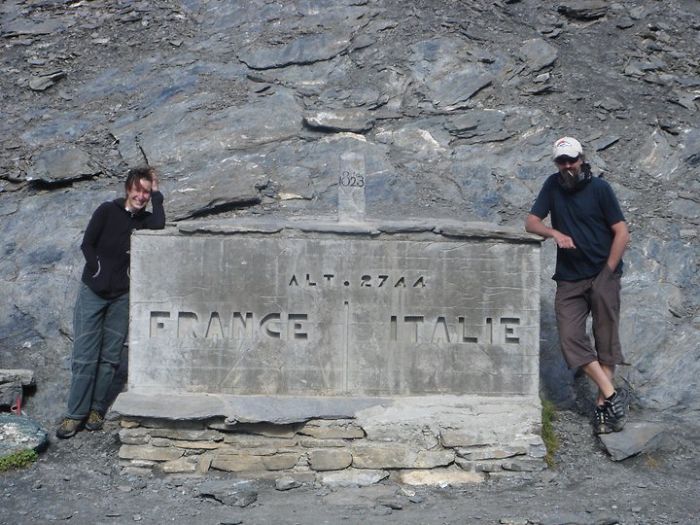
Image source/reddit
The border between France and Italy runs along the Alps mountain range. The border is 515 kilometres long. Because there's no physical order it is often disputed, the Italians and the French regularly contest where the summit of the border lies, some want the border equally set on Mont Blanc.Advertisement
Syria, Jordan and Israel
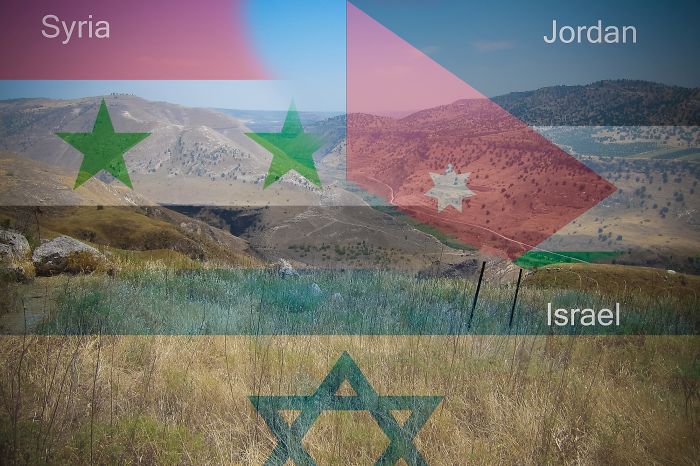
Image source/bored panda
The Jordan-Syria border runs a huge 262 kilometres long. The border forms a kind of triangle with Israel, Jordan and Syria. In 1979, Egypt and Israel formed a peace treaty and in 1994 Israel and Jordan also formed a peace treaty. The border is patrolled and you need a visa to cross.Advertisement
Tanzania and Kenya
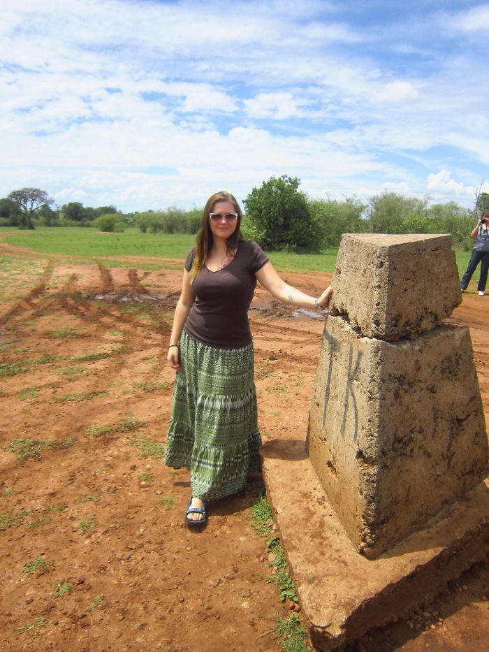
Image source/reddit
Tanzania shares a border with Kenya and it stretched 758 kilometres long. The border wasn't created by the countries themselves, it was made by both British and German colonial governments back in 1893 to separate the neighbouring countries. There are five different connections along the border.Advertisement
Egypt and Saudi Arabia
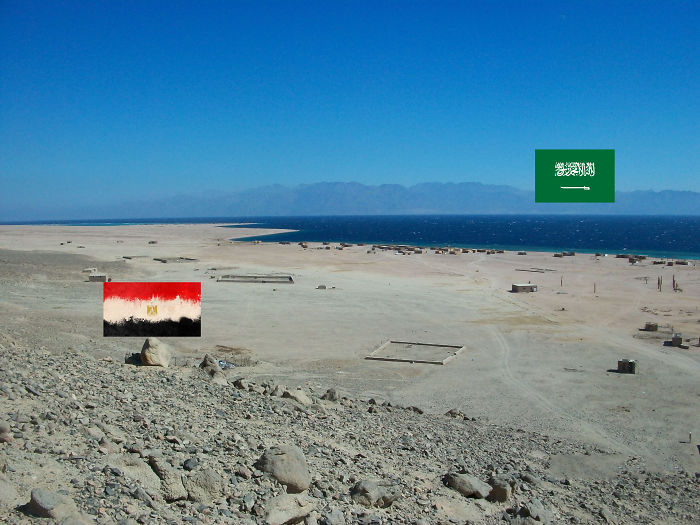
Image source/bored panda
The Red sea lies in-between Egypt and Saudi Arabia. In 2016 the two countries finally agreed the ocean boundary which lies in the Gulf of Aqaba and the Red Sea. This marked the end of a disagreement which had continued historically and regarded the territory of the Tiran and Sanafir Islands.Advertisement
Italy and Slovenia
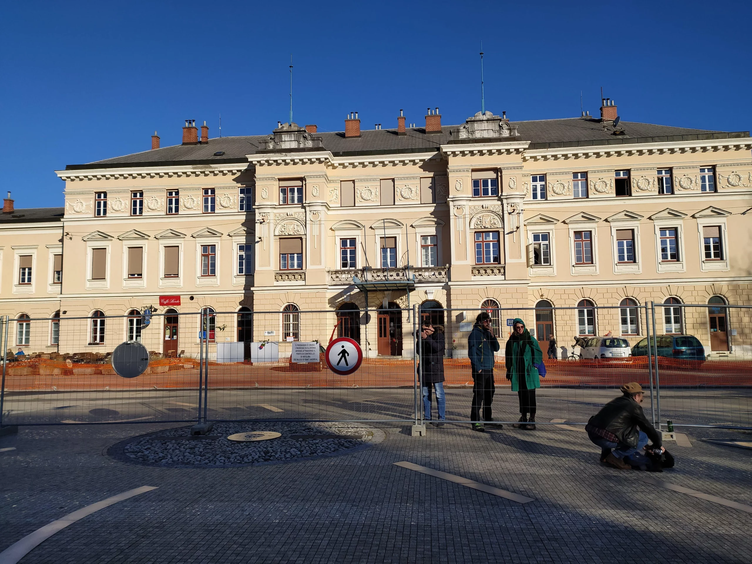
Image source/reddit
The Italian and Slovenian border is 232 kilometres long and runs diving the two countries. The border continues over land and ends in The Bay of Muggia which is entirely Italian owned territory. To pass these borders a passport or identity documentation is needed.Advertisement
Slovakia and Poland
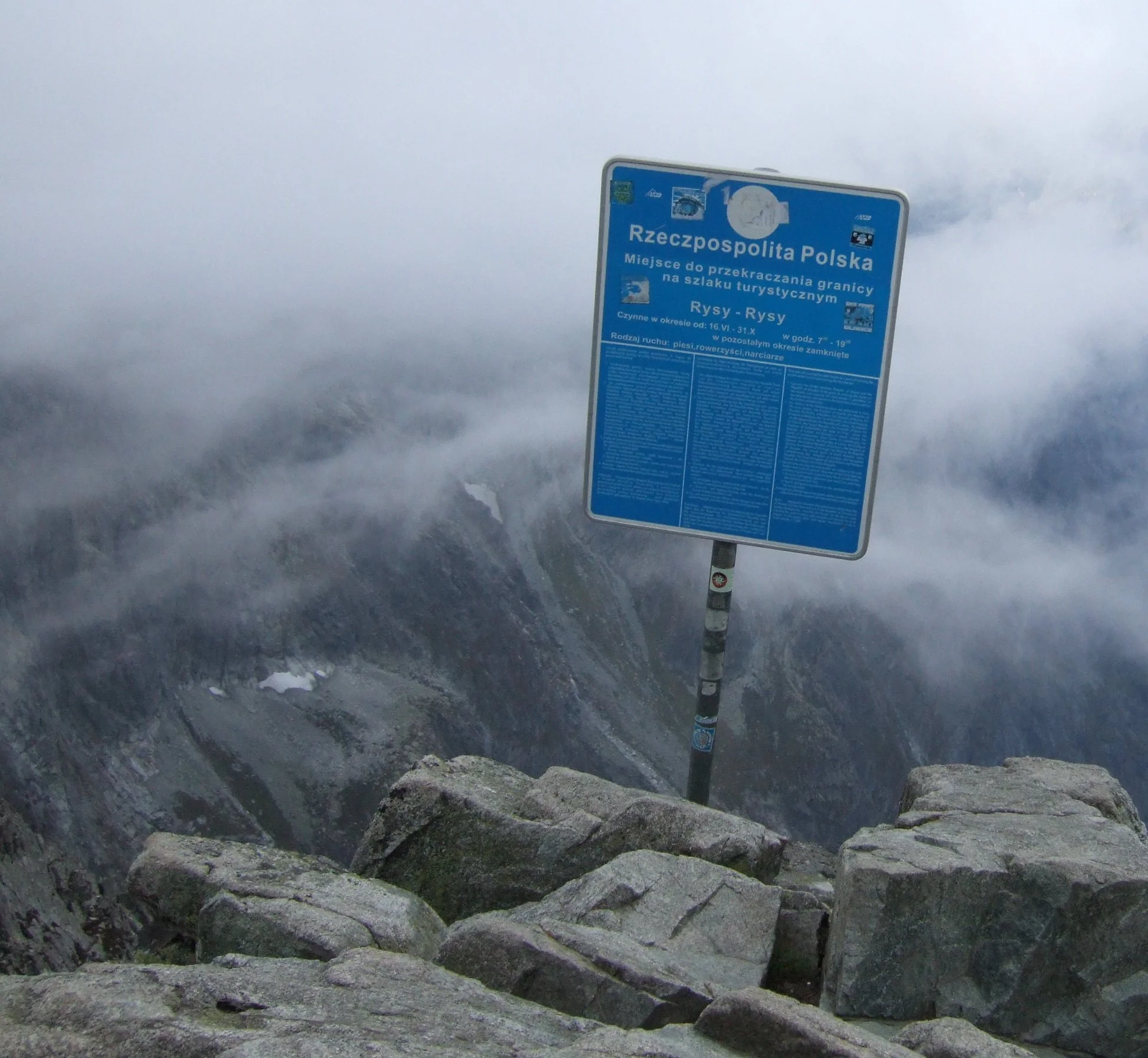
Image source/bored panda
The border which runs between Slovakia and Poland and was formally introduced in the year 1993. The border follows the main ridge of the Tatras Mountains, separating the two countries from one another, despite there being no official physical border between the two countries.Advertisement
Luxembourg and Germany
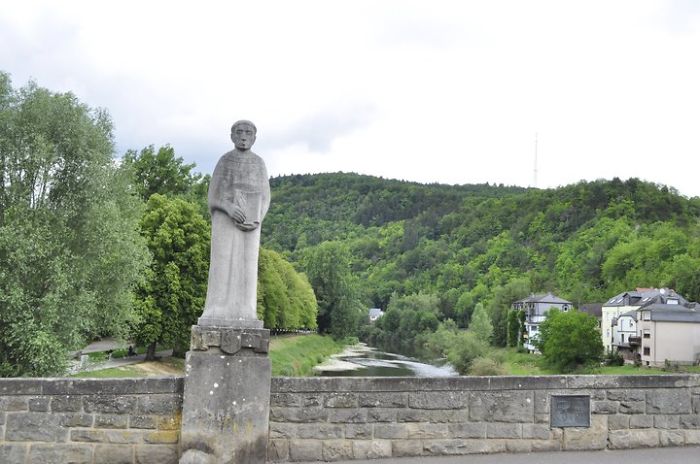
Image source/reddit
Luxembourg and Germany share a land border spanning 138 kilometres. There are sections of the border which are shown by the physical creation of walls, such as this wall and statue shown here. In other places, there is no border to separate the land between the two.Advertisement
Alaska, USA and Yukon and Canada
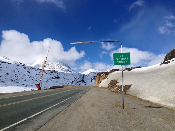
Image source/bored panda
The Alaska/ Yukon border signifies the border between Canada and the USA. This border actually represents the largest border that is undefended - in the entire world. There is no real separation between the countries and the border continues to remain without defence.Advertisement
North and South Cyprus
Image source/reddit
There have been continuous disagreements between both North and South Cyprus, as such the constant tensions between led to the creation of a border. There is now a north, south divide. This border separated one from the other, it is known as 'the Green Line 1.Advertisement
Iran and Iraq
Image source/bored panda
There are not only one line between Iran and Iraq, there are four border crossings between the two countries. The war lines here represent part of the border. These war lines have been there and visible for 26 years. Since the referendum, the border is now open to tourists.Advertisement
Kim Bridge, Bahrain and Saudi Arabia
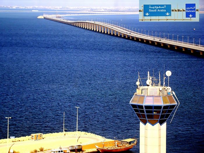
Image source/reddit
This is the King Fahd Causeway, it is 25 kilometres in length and it connects Saudi Arabia to Bahrain. The impressive structure is formed of 536 concrete pillars as it forms a bridge over the Gulf. There is an island built in the middle which holds immigration and customs facilities.Advertisement
Wagha border, India and Pakistan
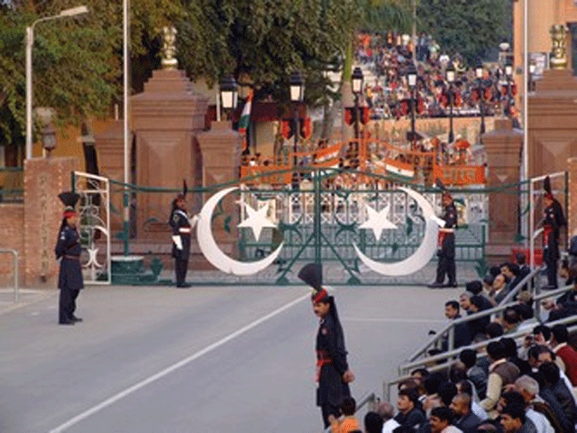
Image source/bored panda
The Wagah border between India and Pakistan. There are regular border ceremonies which the town has actually become famous for. There are daily military processions on the border which display the military forces of both countries, side by side. Goods are also taken between countries at this point.Advertisement
Mexico and Guatemala
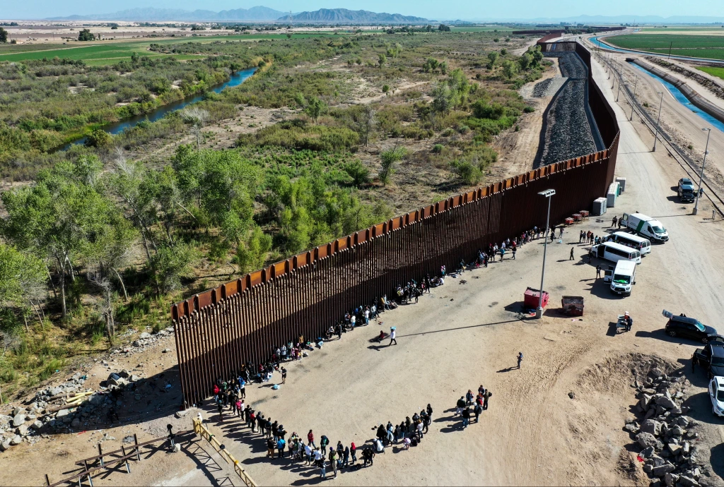
Image source/reddit
The Guatemala-Mexico border is huge. It spans 981 km, it crosses land, hills, and rovers. There are a few points of the border in which travelling from one side to the other are legal to do so on foot or by vehicle. The border between the two countries is patrolled.Advertisement
Beliz and Guatemala
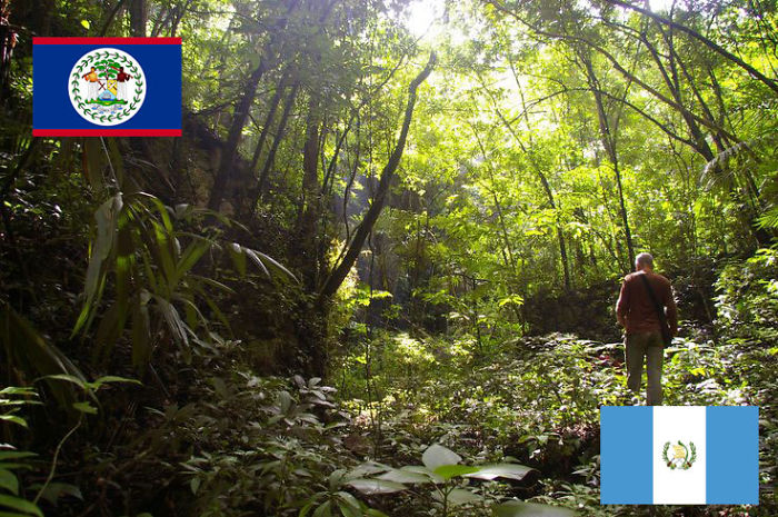 Image source/bored panda
The Belizean-Guatemala border is 266 kilometres long, running pretty much in a straight line. But, there are continuous disputes between the two countries regarding the territory of each. And so, the border issue is still unresolved today and remains a point of contest.Advertisement